
Using the BLM’s General Land Office (GLO) Records Tool
Why It Matters
Understanding the historical roots of a ranch can offer more than just perspective, it can provide insights into water rights, access routes, grazing history, and patterns of land division that still affect ownership today. Whether you’re curious about the original homestead claimant or need a copy of the patent, the General Land Office Records database is one of the most powerful tools available to landowners and buyers.
What You Can Find with the GLO Records Tool
-
Original Homestead Patents: View and download the actual signed land patents issued by the federal government to early settlers.
-
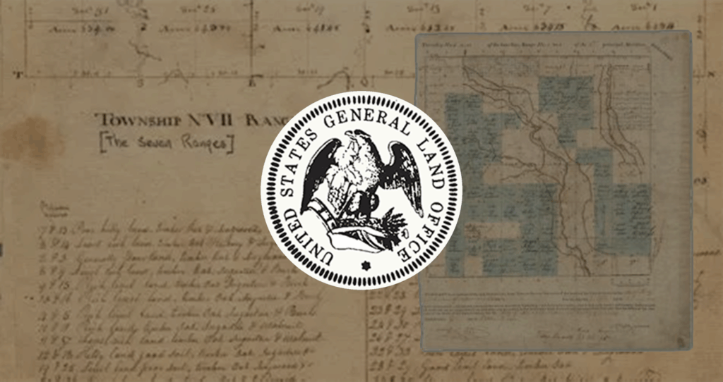
Survey Plats and Field Notes: Access township-level plats showing property boundaries, water features, roads, and other notations from the original land surveys.
-
Land Status Records: Trace transfers, cancellations, and mineral reservations history.
How to Use the GLO Records Tool
-
Visit: glorecords.blm.gov
-
Click “Search Documents.”
You can search by state, county, legal description (e.g. Township 3 North, Range 2 East), or name. -
Filter by Document Type:
Choose from land patents, survey plats, tract books, or control document indexes. -
Download & Save:
All documents are available for free download as PDFs or TIFF files, complete with signature pages and legal annotations.
Pro Tips & Interesting Finds from the GLO Records Tool
1. Survey Plats Sometimes Show Long-Lost Roads, Trails, or Cabins: Zoom in on old plats and you’ll often find hand-drawn notations showing wagon trails, log cabins, fence lines, or springs. These features can help explain existing easements or structures on your land today.
2. You Might Find Water Rights or histories on Mineral Reservations: Many land patents include mineral rights carve-outs or notes about adjacent ditches and canals.
3. Compare the Original Plat to Modern Aerials for a Fascinating Look at Change: Use tools like Google Earth Pro or On X to overlay old survey plats on satellite imagery — it’s a great way to visualize how the landscape, timber, and even waterways have shifted over time.
4. Check Neighboring Tracts for Patterns:
If your land was part of a larger block of homesteads, scanning nearby parcels can reveal who settled the area, how it was subdivided, and what historical use patterns might still be visible today.
Use the Glo Records Tool
Swan’s Perspective
At Swan Land Company, we believe that understanding the full story of a property and its history can be incredibly valuable. For legacy ranches, these records can offer insights into the land’s history and so much more. These documents are more than historical artifacts. They can shape real-world decisions about stewardship, boundaries, and long-term planning. Whether you are preparing to buy, ready to sell, or simply want to better understand the land you own, these tools give you access to a wealth of historical resources.